
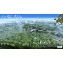
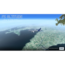
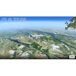
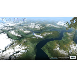
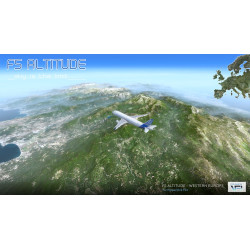
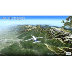
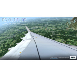
The FS Altitude scenery range is primarily designed for airliner flight at high and medium altitudes. Its main purpose is to replace the default, synthetic, and extremely repetitive scenery (called "Landclass") with photorealistic textures derived from satellite imagery at a resolution of 14.25 meters.
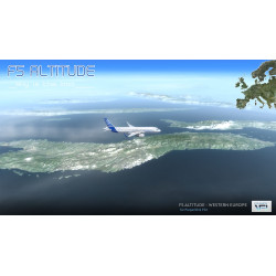
These lower-resolution textures, sufficient for high and medium altitudes, result in an optimal frame rate (FPS) with extremely fast loading times. This conserves resources for the aircraft's systems and provides a consistent and highly realistic exterior visual, while prioritizing higher-resolution scenery at lower altitudes.
Data sheet
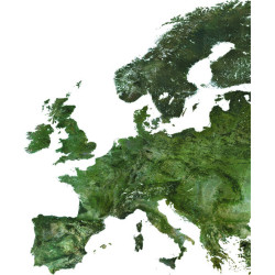
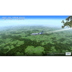
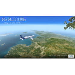
The FS Altitude Western Europe scenery covers the entirety of Western Europe, spanning over 5 million km², with low-resolution, photorealistic textures optimized for airliner flight at cruising altitude.
WORKING PROCESS
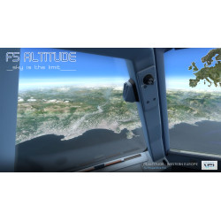
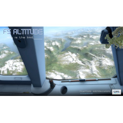
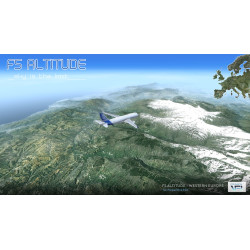
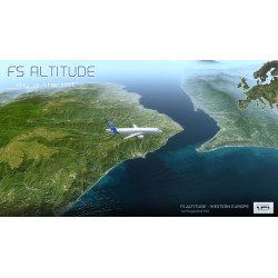
Due to the low resolution of the textures used, the P3D/FSX graphics engine only displays them at a certain distance from the aircraft, starting from the point where the Level of Detail (LOD) decreases with distance. FS Altitude therefore exploits this characteristic of the graphics engine, which always maintains a zone directly above the aircraft with a diameter of several tens of kilometers. This zone displays the default P3D/FSX landclass textures, or any other installed scenery (airports, etc.).
It is therefore possible to use FS Altitude without the textures covering the entire environment. During takeoff or landing, the add-on scenery remains visible around the aircraft, and it is only at a certain altitude that the low-resolution textures take over. This principle applies throughout the entire flight. Since the product is designed for medium and high altitude flight, it is no longer possible, given the maximum viewing angle, to see this area progressing at the same time as the aircraft and at ground level, and the immersion is total thanks to the distant visual of the low resolution textures.
SPECIFICATIONS
The FS Altitude scenery range is primarily designed for airliner flight at high and medium altitudes. Its main purpose is to replace the default, synthetic, and extremely repetitive scenery (called "Landclass") with photorealistic textures derived from satellite imagery at a resolution of 14.25 meters.
These lower-resolution textures, sufficient for high and medium altitudes, result in an optimal frame rate (FPS) with extremely fast loading times. This conserves resources for the aircraft's systems and provides a consistent and highly realistic exterior visual, while prioritizing higher-resolution scenery at lower altitudes.