RHONE-ALPES VFR VOL.1 FOR P3D

34.90€
Prix/Price incl. 20% TVA/VAT

Photo-realistic scenery representing the northern half of the Rhone-Alpes region in high definition textures of 1 meter / pixel, very high definition mesh 4.75 meters, full autogen and 3D coverage, numerous objects and VFR landmarks (lighthouses, bridges, ports , anchorages, wind turbines, pylons, monuments ...), detailed port areas.

“VFR Regional” products benefit from all the contributions of 3DAutomation® technology developed by France VFR.

This technology makes it possible to implement the most dense and realistic environments ever designed for P3D. It does not claim to represent reality precisely but to give it the most realistic possible interpretation on a very large scale. It may eventually evolve to adapt to needs and to the new data available. Seabed modeled over the entire scene.

Quantity

Data sheet

Release date
18/10/2019
Compatibility
P3Dv5-v4
Size on disk
14 Go
Number of file(s)
7

Characteristics

  • Ground textures of 1 meter / pixel resolution from IGN aerial photos reworked for optimal visual rendering in Flight Simulator X® (summer only).
  • Very high definition specific mesh (relief) 4.75 meters real (LOD13).
  • Lakes and rivers completely cut out with navigable water.
  • Management of seabed transparency over the entire scene.
  • Semi-detailed airports and aerodromes including correction of “platform” effects.
  • Obstacles and VFR landmarks modeled on the entire scene including the official SIA database (antennas, pylons, water towers, wind turbines, various constructions).
  • Several hundred thousand remarkable objects and buildings integrated into the environment (churches, power stations, silos, castles, industrial tanks, bridges, tolls, cranes, boats, lampposts, road signs).
  • Integration of 3D Automation® technology allowing the modeling of several million buildings and realistic vegetation zones adapted to the region.
  • Extremely dense and realistic vegetation cover optimized thanks to a rendering module driven by artificial intelligence (AI).
  • Complementary Autogen buildings including specific and optimized 3D variants.
  • Geo-referenced alignment ensuring maximum compatibility with future add-ons installed in the same area.
  • Development process 100% compliant with Microsoft® SDK specifications, ensuring maximum compatibility when new versions arrive.

Information

Here is the scene coverage map as well as the various aerodromes / airports / ULM bases.
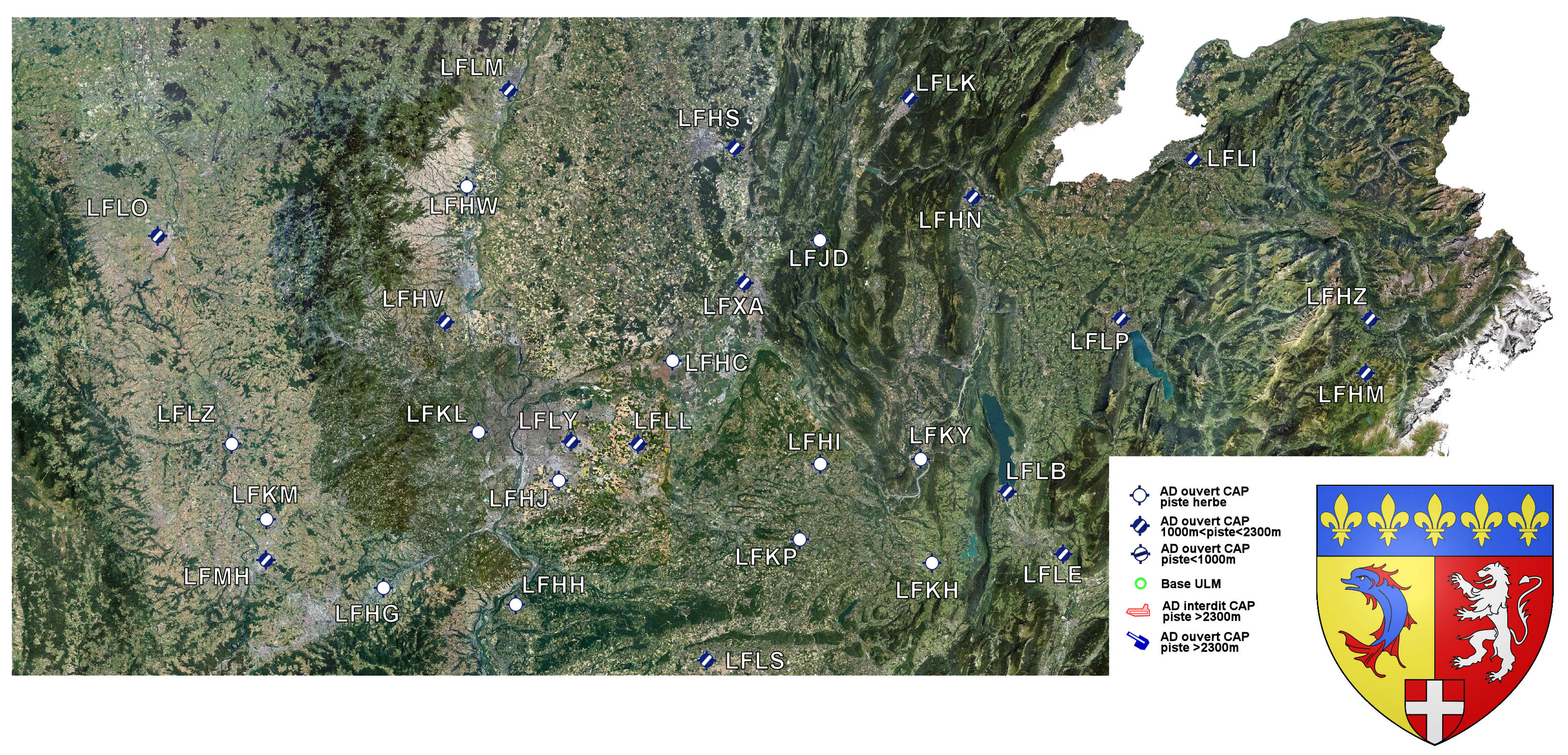
Stage coverage

You might also like